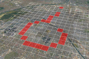
Geolocation Satellite imagery From Mauritius to Sudan, You Told Us Where To Look. Here Are the Results
OSINT Tools Find the Right Open Source Research Tools With Bellingcat’s New Online Investigations Toolkit
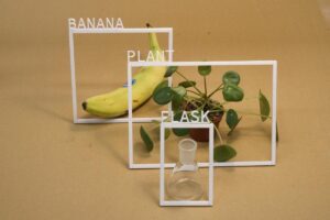
AI Imagery Analysis Easy AI: A Simplified Approach to Classifying Images with Off-the-Shelf AI Models
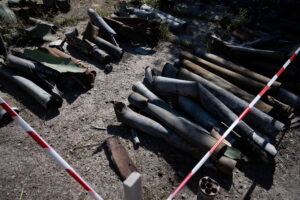
Open Source Evidence Social Media A Beginner’s Guide to Identifying Explosive Ordnance in Social Media Imagery
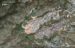
Satellite imagery West Bank How to Use Free Satellite Imagery to Monitor the Expansion of West Bank Settlements